Lake of the Ozarks Maps & Visitor Guides
Your Complete Lake of the Ozarks Resource Hub — Maps, Guides & Local Insider Tips. Planning a trip to Lake of the Ozarks? Whether you're a first-time visitor or a returning regular, this page brings together the essential maps, official visitor guides, and local insider resources you'll need — all curated by BlueCat Properties, a locally operated vacation rental host at Indian Pointe Resort in Osage Beach, Missouri (mile marker 17). Lake of the Ozarks is one of the largest man-made lakes in the United States, with over 1,150 miles of shoreline, 54,000 surface acres, and three main arms — the Osage (main channel), Grand Glaize, and Gravois. Below you'll find downloadable maps for mile markers and boat ramps, links to the official CVB vacation guide and golf trail guide, plus our curated Insider Visitor Guides covering waterfront dining, lodging, trails, events, and more.
Lake of the Ozarks Vacation and Service Guide (CVB)
The Lake of the Ozarks Convention & Visitors Bureau (Funlake CVB) publishes a free annual Vacation & Service Guide — the most comprehensive official resource for trip planning. The 2026 digital edition covers lodging options from resorts to vacation home rentals, dining guides, a full calendar of events, water recreation outfitters, shopping at Osage Beach Premium Outlets and the Bagnell Dam Strip, and family-friendly attractions. This is the go-to starting point for first-time visitors. Click the image below to access the digital flipbook edition, or request a free print copy through the CVB website at funlake.com.
Lake of the Ozarks Golf Trail Guide
The Lake of the Ozarks Golf Trail features more than 12 courses carved through the Ozark Hills of Central Missouri, making it one of the Midwest's premier golf destinations. Courses range from championship-level layouts like The Lodge of Four Seasons' Cove and Ridge courses to scenic community favorites like Sycamore Creek and Bear Creek Valley. Many courses offer lake views, and most are open to the public with tee times available seasonally from March through November. The Golf Trail Guide brochure (linked below) includes course maps, yardage details, and contact information for each course.Lake of the Ozarks Lake Access Ramp Map
If you're trailering a boat to the lake, this ramp access map is essential. Lake of the Ozarks has dozens of public launch ramps managed by Missouri State Parks, Ameren Missouri, and the U.S. Army Corps of Engineers. Popular ramps include the state park ramp near Grand Glaize Bridge, Public Beach #2 off US-54, and several access points along the Gravois arm. The map below shows all public ramp locations, and many marinas also offer paid launch and retrieval services with trailer parking. If you'd rather skip trailering entirely, BlueCat Properties offers boat rentals — including a 27' Lowe Tritoon and a 41' Sea Ray — with dock access and slip rental right at Indian Pointe Resort.
Lake of the Ozarks Mile Marker Map
Navigating Lake of the Ozarks is much easier when you understand the mile marker system. Mile Marker 0 begins at Bagnell Dam (built in 1931 to impound the Osage River), and markers increase as you travel southward up the main Osage arm toward Truman Dam at approximately the 92-mile mark. Restaurants, marinas, vacation rentals, and coves are typically identified by their nearest mile marker — for example, all BlueCat Properties vacation homes are located at Indian Pointe Resort at the 17-mile marker, a central and highly accessible location on the main channel. The Grand Glaize arm and Gravois arm use their own mile marker numbering systems, branching off the main channel. The map below shows the full mile marker layout.
Frequently Asked Questions About Lake of the Ozarks
Q1: How do mile markers work at Lake of the Ozarks?
A1: Mile markers at Lake of the Ozarks measure the distance from Bagnell Dam, which is Mile Marker 0. Locations along the lake reference these markers to help visitors navigate — for example, Indian Pointe Resort is located at the 17-mile marker on the main channel. Mile markers increase as you travel up the Osage arm (the main channel), with the Grand Glaize arm and Gravois arm having their own separate numbering systems. Most marinas, restaurants, and vacation rentals identify their location by mile marker.
Q2: Where can I launch a boat at Lake of the Ozarks?
A2: Lake of the Ozarks has numerous public boat ramps managed by the Missouri State Parks and Ameren Missouri. Popular public ramps include those at Lake of the Ozarks State Park, Public Beach #2 near Osage Beach, and several Corps of Engineers access points. The Lake Access Ramp Map available on this page shows all public launch locations around the lake. Many marinas also offer paid launch services with trailer parking.
Q3: How big is Lake of the Ozarks?
A3: Lake of the Ozarks covers approximately 54,000 surface acres with over 1,150 miles of shoreline — more shoreline than the coast of California. The lake stretches roughly 92 miles from Bagnell Dam to Truman Dam and was created in 1931 by impounding the Osage River. It has three main arms: the Osage (main channel), the Grand Glaize, and the Gravois.
Q4: What is the best area to stay at Lake of the Ozarks?
A4: The Osage Beach area (roughly mile markers 14–21) is considered one of the best areas for visitors because it offers central access to dining, shopping, attractions, and the lake's main channel. Indian Pointe Resort at the 17-mile marker is a popular choice for families and groups, offering waterfront vacation homes with private docks. The Lake Ozark/Bagnell Dam Strip area is known for nightlife and entertainment, while the Camdenton/Hurricane Deck area offers a quieter experience closer to the state park.
Q5: What are the best things to do at Lake of the Ozarks?
A5: Lake of the Ozarks offers boating and watersports, waterfront dining at pool bars and restaurants, over 12 golf courses on the Lake of the Ozarks Golf Trail, hiking at Ha Ha Tonka State Park and Ozarks trails, winery and brewery tours, fishing for bass and crappie, shopping at Osage Beach Premium Outlets, family attractions like Bridal Cave and Big Surf Waterpark, and a packed calendar of annual events including the Lake of the Ozarks Shootout boat races, AquaPalooza, and the Polar Bear Plunge.
Q6: Where can I find a free Lake of the Ozarks visitor guide?
A6: The Lake of the Ozarks Convention & Visitors Bureau (CVB) publishes a free annual Vacation & Service Guide, available online as a digital flipbook and in print at visitor centers and local businesses. This page includes a direct link to the digital guide, along with golf trail guides, boat ramp maps, and mile marker maps — all free to access and download.
BlueCat Properties Lake of the Ozarks (LOTO) Insider Visitor Guides
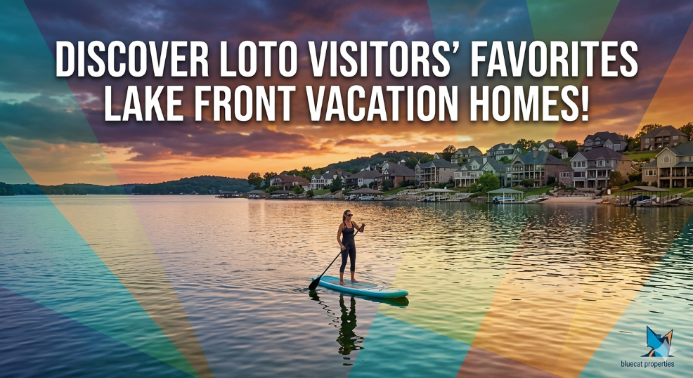
Beyond the maps and official guides above, our LOTO Insider series covers the best of Lake of the Ozarks in depth — from the top waterfront restaurants with pool bars and beaches, to the best golf courses, hiking trails, wineries, and major events. These guides are written from local experience operating vacation rentals on the lake and are updated annually with the latest venue information, hours, and seasonal details.
Visitor Guide for 14 Top Waterfront Restaurants & Bars with Pool or Beach at the Lake of the Ozarks
Visitor Guide - Top Lodging Areas Lake Ozarks
Visitor Guide for Best Attractions and Entertainment at the Lake of the Ozarks
Visitor Guide for Wineries, Distilleries, and Breweries at Lake of the Ozarks
Visitor Guide to Calendar of Events at the Lake of the Ozarks
Visitor Guide to Top Hiking and Bike Trails Lake of the Ozarks
Visitor Guide of the Best Golf Courses at the Lake of the Ozarks
About BlueCat Properties
BlueCat Properties is a locally owned and operated vacation rental company at Indian Pointe Resort in Osage Beach, Missouri, on the Lake of the Ozarks. Our insider guides and visitor resources are written from years of hands-on experience hosting guests at the lake. For questions or trip planning help, contact us at info@bluecat.properties or 573-723-1050.


